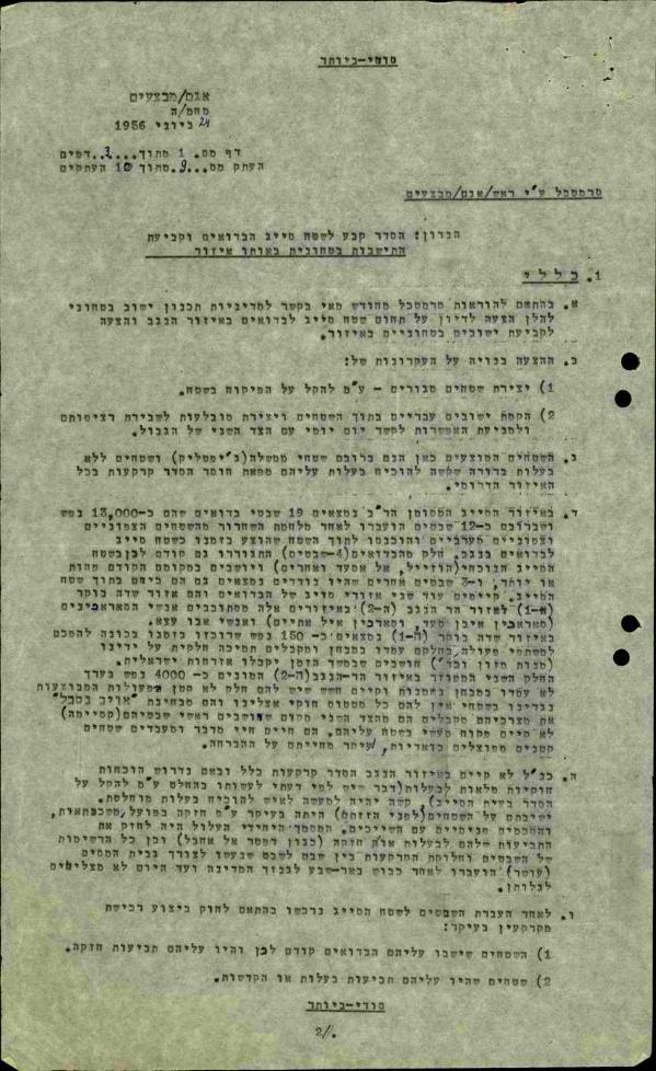
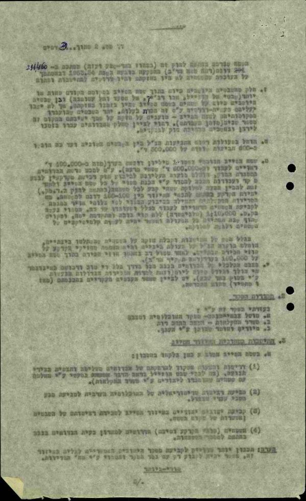
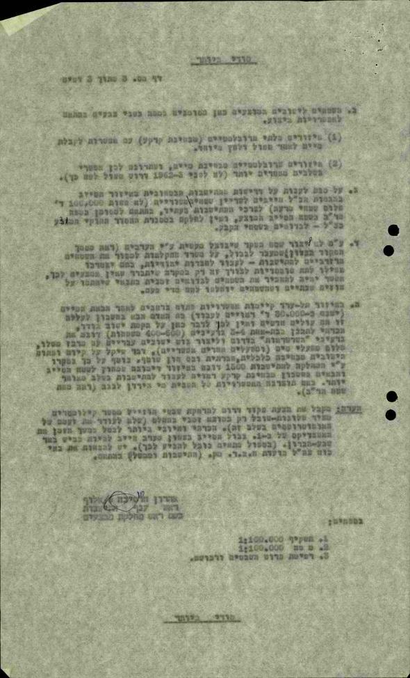
The Siyag area was established with the aim of concentrating the Bedouins who remained in Israel after the 1948 war and enabling control of their movements. It stretched over 1.1 million dunams, or some 10% of the Negev (or in Arabic Naqab). A document from June 1956 lists several changes to the Siyag’s boundaries and refers to the transfer of Bedouins in the service of Israeli interests in the area.
When the war broke out in 1948, the Negev was home to a population of 65,000-70,000 Bedouins, members of roughly 100 tribes, who practiced a semi-nomadic way of life. Over the course of August and September 1948, members of the “Negev” and “Yiftah” brigades engaged in a series of operations that included the expulsion and concentration of the Bedouin population in the Negev. Expulsions continued after the fighting ended, and shortly after the end of the war only 12,000 Bedouins belonging to 18-19 tribes remained in the Negev. At the time, about 3,000 Jews lived in the Negev in three communities.
While entire tribes were expelled from the country, the remaining Bedouin population was concentrated in an area that had been allocated to them and designated as a closed military zone named the Siyag. It stretched over 1.1 million dunams (or 1000 square kilometers) approximately 10% of the Negev, between Dimona, Arad, Yeruham and Beersheba. The Siyag’s inhabitants were under Military Rule until December 1966, and permits were required to enter or exit it. The concentration of Bedouins in the Siyag was meant to “facilitate control” over Bedouins’ movement and aid in what was referred to as “land consolidation” for the purpose of building Jewish communities (mainly in the western Negev). Such communities were often referred to as “security settlements” in the documents of the time, including the one posted here.
The concentration and expulsion of Bedouin tribes produced seismic political, social, and economic changes within the community. Many members of the Bedouin community were forcibly removed from the areas they inhabited, and family ties unraveled. Additionally, the Siyag’s boundaries occasionally changed to suit Israel’s military and settlement pursuits.
The document posted here, sent by Lieutenant Colonel Aharon Harsina, Head of the Operations Directorate Settlement Branch to Chief of Staff Moshe Dayan, describes the placement of Bedouin tribes in the Siyag halfway through 1956 and states a need to make changes to the Siyag’s boundaries for the purpose of “establishing Hebrew communities within the areas and creating enclaves to break the contiguity” of Bedouin hubs in the Negev.
One of the issues facing Israel was land ownership. After independence, Israel enacted several laws intended to help it take over land in the Negev (and other areas), including the Land Acquisition Law mentioned in the letter. In parallel, “land arrangements” were undertaken in a bid to determine ownership and put disputes to rest. Interestingly, in the final paragraph of the letter, Harsina notes he accepts the Southern Command’s proposal to move the Hozayel tribe several kilometers away from its location at the time “as a decidedly temporary solution.” Harsina’s remarks reveal that he favored a temporary removal not because of concern over disrupting the lives of tribe members, but rather over reactions inside Israel. Keeping the move temporary was meant to “avoid angering the guardians at this point.” It is not entirely clear to whom Harsina was referring, whether these “guardians” were officials from the Custodian of Abandoned Property’s office or representatives of Jewish communities in the area – including from the kibbutz communities of Dorot and Ruhama, who had intervened on behalf of the members of the Hozayel tribe.


