Looking at an official map of Israel, the impression is that the country’s territory stretches from the Mediterranean Sea in the west to the Jordan River in the east. This is because maps printed in Israel do not show the Green Line separating Israel’s sovereign territory from the territories it occupied in 1967. The disappearance of the Green Line from the map is not accidental – it is the result of secret resolutions made by the Israeli government several months after the Six Day War. Transcripts of the Security Cabinet discussions and related documents are presented here.
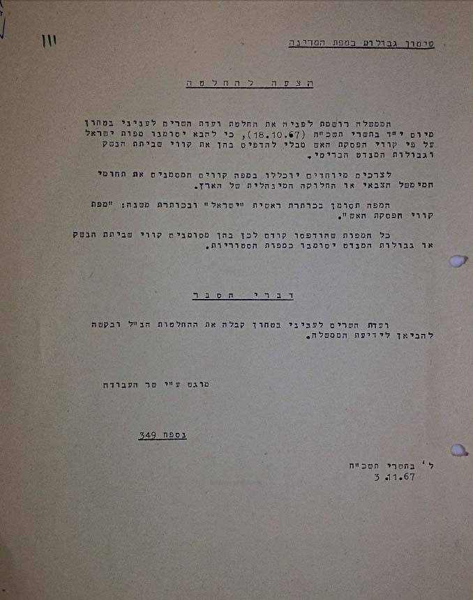
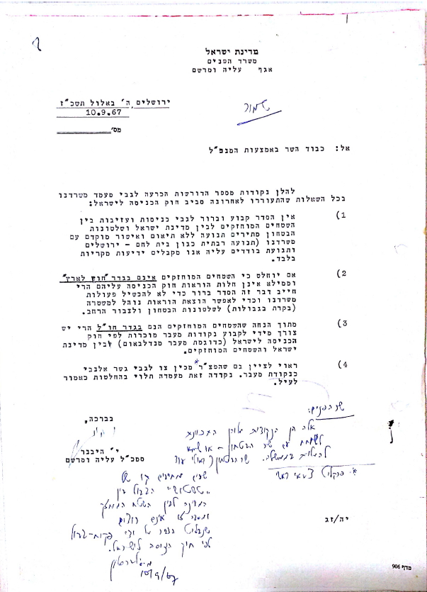
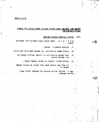
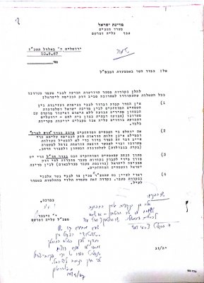
On Wednesday, October 18, 1967, Labor Minister Yigal Allon, proposed a resolution to the Ministerial Committee on Security (Security Cabinet). The proposition was that Israel would no longer print the Green Line – the 1949 Armistice Line, on its official maps. Instead, the border shown on the map would be the line where the IDF deployed at the end of the 1967 War, including the Golan Heights, the Sinai Peninsula, the Gaza Strip, and the West Bank.
In the cabinet’s first discussion of this issue, held on October 18, 1967, Minister Allon explained that with the occupation of the Territories in the Six Day War, the government declared that the 1949 armistice had been revoked and that this had to be reflected in the maps. “Issuing a new map according to the [1949] Armistice Lines,” Allon said, “would not reflect the political reality and would be taken to mean that we still consider these lines an eventuality.” Minister of Foreign Affairs Abba Eban asked not to emphasize the distinction between the now-annexed Jerusalem and the remaining West Bank on the map, while Minister of Defense Moshe Dayan proposed the 1949 Armistice Lines appear on the map alongside the 1967 Ceasefire Lines and the international borders. “A map isn’t a policy program”, Dayan said.
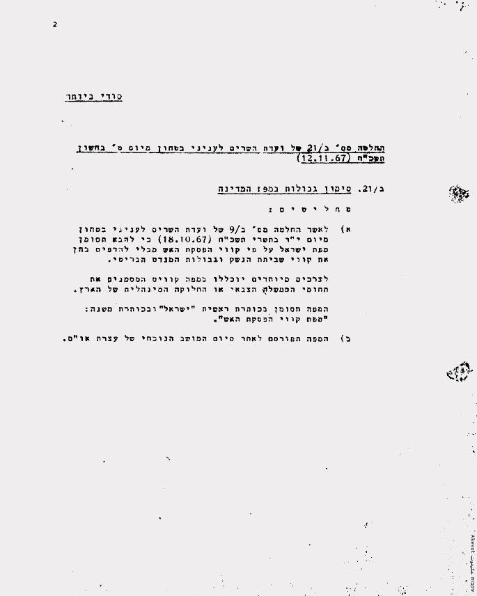
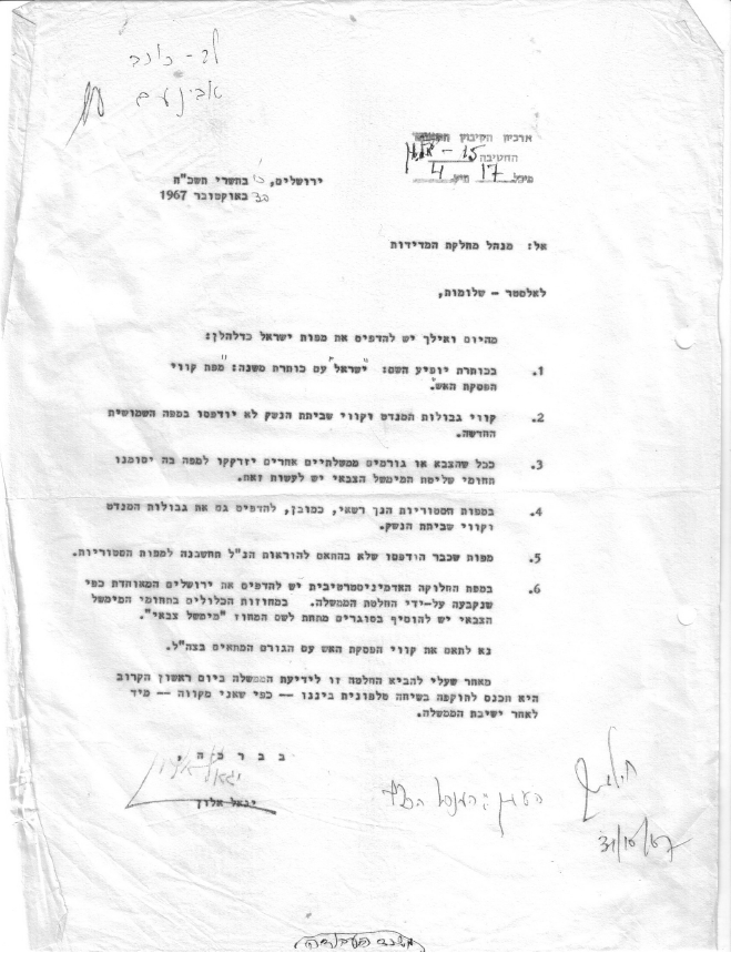
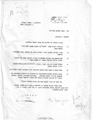
The ministers also discussed what colors to give the various parts of the territories on the map; whether the map would be titled the State of Israel or Israel and whether to mark the areas of the military government inside the occupied territories. The ministerial committee accepted Allon’s proposition with a landslide majority, and the resolution was given the title Resolution B/9 “Depiction of borders on maps of the country”. Prime Minister Levi Eshkol wanted to reach a consensual decision and so, after the cabinet approved the changes to the map, he “ordered” an appeal from Minister of Health Yisrael Barzilai in order to reopen the discussion.
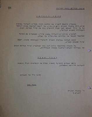
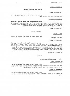
The second discussion on this issue was held on November 12, 1967, also in the security cabinet, with ministers debating the demarcation of the Green Line on future maps at length. Allon suggested censoring publications of the decision to print maps without the Armistice Lines and the discussion then veered toward the status of the Latrun area. The ministers ultimately reaffirmed the decision to stop marking the Green Line on government-printed maps and to issue a media blackout on the decision itself. The committee ratified the resolution it made three weeks earlier in a new resolution, marked B/21.
At the request of Eban and understanding the possible international implications of publishing a new map, printing was pushed back until after the UN General Assembly was over. The two resolutions made by the ministerial committee regarding the erasure of the Green Line from the map were classified as “top secret” and were not made public. Official maps began to be printed without the Green Line, and privately- printed maps in Israel soon followed.